
作品圖片 柬埔寨地圖 (點擊將開啟燈箱)
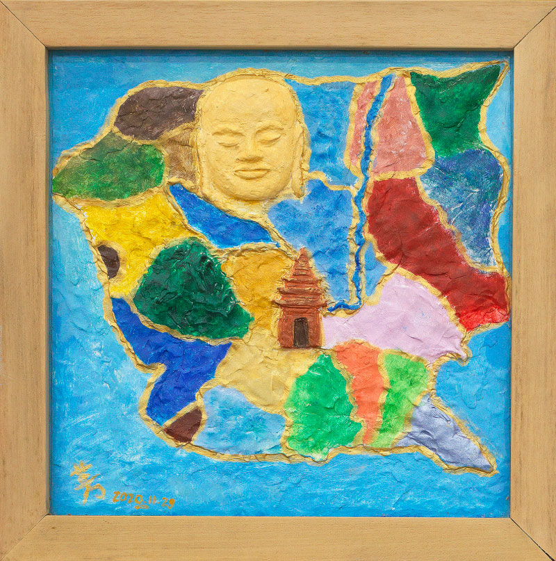
柬埔寨地圖 Map of Cambodia
作者 張慈芳/陳妍妤 Author Zhang Ci-fang/Chen Yan-yu
媒材 黏土畫 Medium Clay mural
國家 柬埔寨 Country Cambodia
尺寸 39 × 39 cm Size 39 × 39 cm
作品賞析 Artwork Appreciation
藝術家想介紹柬埔寨美麗的歷史給大家認識,透過作品讓大家對柬埔寨印象深刻在心裡,地圖上放了三個地標是遊客非去不可的景點。
1-吳哥窟位置在暹粒省,建造在闍耶跋摩七世時代。他的臉像建築在大吳哥窟頂端上,人人稱呼(微笑柬埔寨),意思是代表柬埔寨人民 和善,熱情,善良和個性。
2-金邊(現時代進步都市)在這是 對遊客 購,娛,食,住,行,遊,通通集中在一塊方便的地方。
3-奧拉山是柬埔寨境內的最高峰,海拔1813米,有好空氣,好風景,也是國家大自然動物保護區。這幾年來是愛登山,露營遊客接觸大自然熱門地點。
With this work, the artist wanted to introduce Cambodia’s beautiful culture to the viewer and hopefully leave a lasting impression of the country in his or her mind. The painting is a map with three landmarks that are a must-see for any tourist visiting Cambodia:
1. Angkor Wat, in Siem Reap Province, built during the reign of King Jayavarman VII. His Bayon temple, at the peak of Angkor Wat, has faces of the Buddha on it. The country is often called “Cambodia Smile”, which represents the peaceful, warm, and kind nature of the Cambodian people.
2. Phnom Penh (now a modern city) is a convenient place for visitors to shop, play, eat, rest, and explore in one place.
3. Phnum Aoral mountain is the highest peak in Cambodia with an elevation of 1,813 meters, clean air, and beautiful vistas. It’s also a national nature park and animal conservation area. In recent years it has become a hotspot for mountaineers and campers who want to get closer to nature.